Deprecated: parse_str(): Passing null to parameter #1 ($string) of type string is deprecated in /home4/floatin9/public_html/work1/wp-content/plugins/jetpack/class.jetpack.php on line 4073
Deprecated: ltrim(): Passing null to parameter #1 ($string) of type string is deprecated in /home4/floatin9/public_html/work1/wp-includes/wp-db.php on line 3031
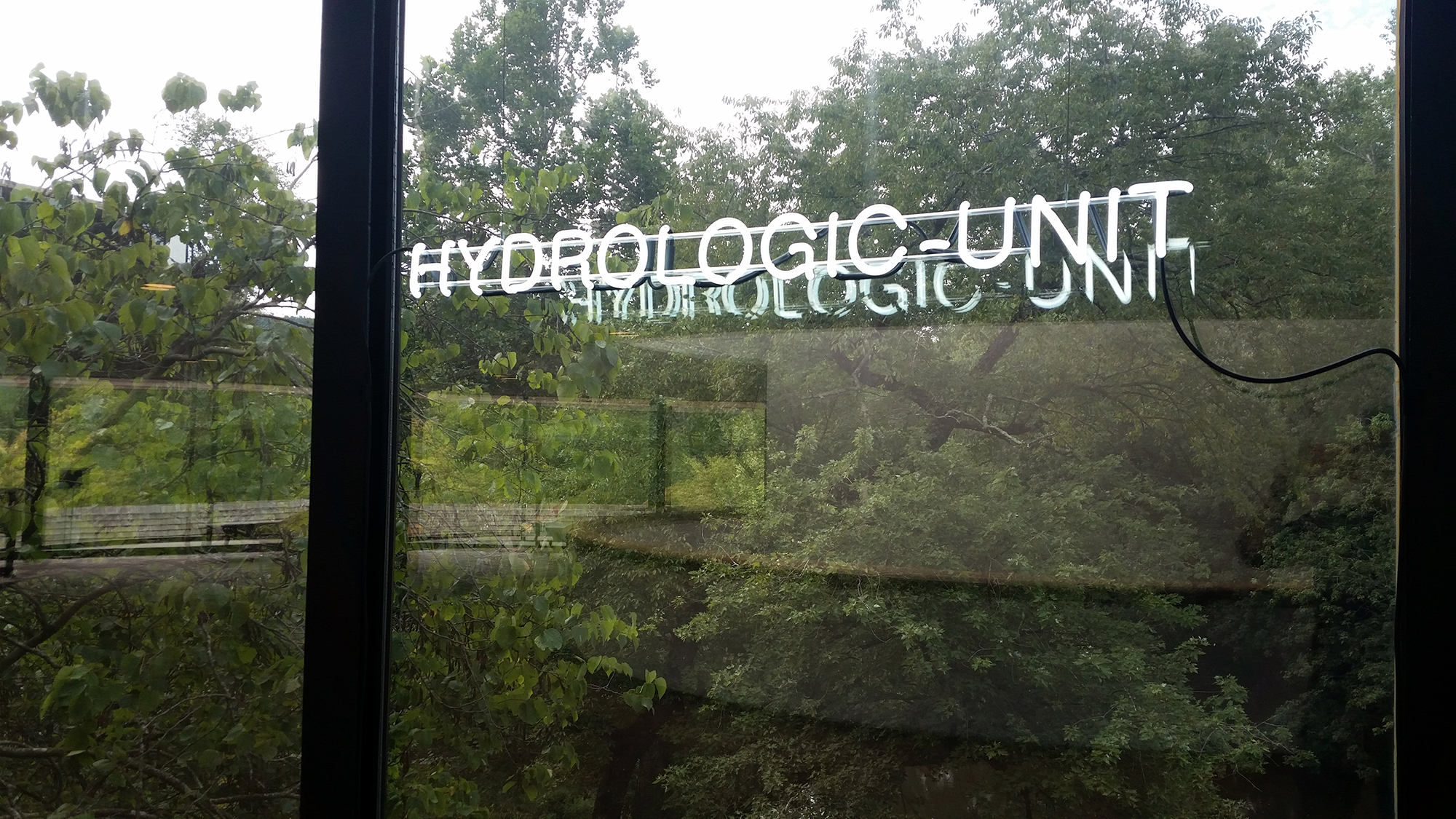
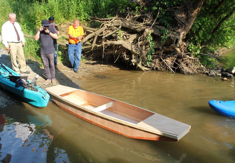
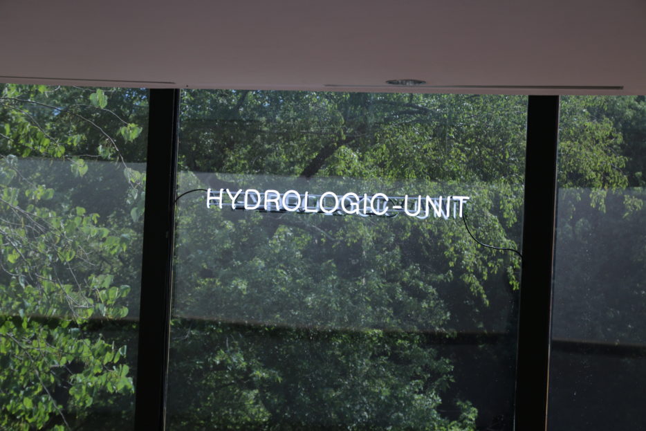
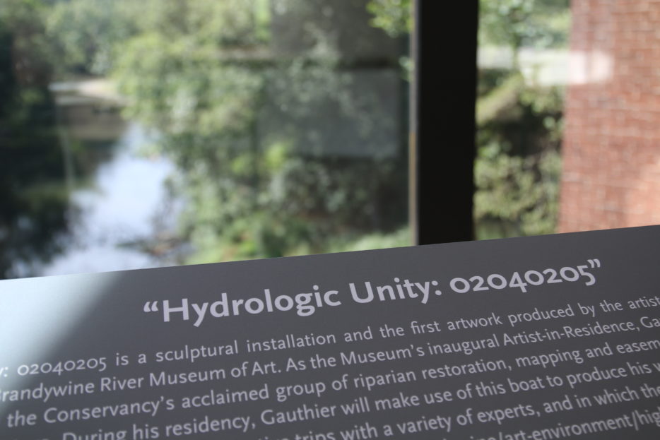
The components of the installation Hydrologic Unity 02040205 include a small punt – a flat-bottomed boat – which the artist constructed along with members the public here at the museum, and a neon piece that references the concept of “hydrologic units” – a system that geologists use to categorize and classify bodies of water throughout the world. The title of the piece references hydrologic unit code (HUC) as well, which is one of the ways the United States Geologic Survey (USGS) designates the Brandywine. This code situates the River within the Mid-Atlantic water-resources region (02), the Delaware sub-region (0204), the Lower Delaware accounting unit (020402), and finally, within the Brandywine – Christina locality (02040205) itself. There is a play on the word “unit” with “unity” which describes the river itself as a link between diverse peoples varying landscapes.
The neon light references the river’s former industrial uses as a source of power. During the Industrial Revolution, the reign was a seat of power and hundreds mills were activated by the Brandywine (including the one you’re standing in now). The neon was fabricated with the specific constraint to use the amount power that the River could generate using an inexpensive consumer grade hydroelectric generator.
° ° °
Regional waterways once dictated where and how cities came to be built, and acted as a connective fabric between distant regions and peoples. They powered industry and provided residents with food and drinking water while serving the public’s needs for both transportation and recreation. My work invites the public to interact directly with their local rivers and streams, and to question the role of these waterways in contemporary American life as a means to thinking about larger ecological topics. The Brandywine flows into the Delaware and rejoins the Atlantic in the Chesapeake Bay, and in a sense, all waters are connected. The sort of work that the Brandywine Conservancy is doing on the Brandywine River contributes not only to clean drinking water for neighboring cities, but to cleaner Oceans.
If rivers are no longer harnessed to generate power, my work also asks: how might these rivers, along with other energy generating technologies, one day be harnessed again?


Deprecated: ltrim(): Passing null to parameter #1 ($string) of type string is deprecated in /home4/floatin9/public_html/work1/wp-includes/wp-db.php on line 3031
...
-
Hydrologic units, hydrologic unit codes, and hydrologic unit names (Modified from Slack and Landwehr, 1992 and Seaber, Kapinos, & Knapp, 1987) Hydrologic Units The United States was divided and sub-divided into successively smaller hydrologic units which were classified into four levels: regions, sub-regions, accounting units, and cataloging units. The hydrologic units are arranged within each other, from the smallest (cataloging units) to the largest (regions). Each hydrologic unit is identified by a unique hydrologic unit code (HUC) consisting of two to eight digits based on the four levels of classification in the hydrologic unit system. The first level of classification divides the Nation into 21 major geographic area, or regions. These geographic areas (hydrologic areas based on surface topography) contain either the drainage area of a major river, such as the Missouri region, or the combined drainage areas of a series of rivers, such as the Texas-Gulf region, which includes a number of rivers draining into the Gulf of Mexico. Eighteen of the regions occupy the land area of the conterminous United States. Alaska is region 19, the Hawaii Islands constitute region 20, and Puerto Rico and other outlying Caribbean areas are region 21. The second level of classification divides the 21 regions into 222 sub-regions. A sub-region includes the area drained by a river system, a reach of a river and its tributaries in that reach, a closed basin(s), or a group of streams forming a coastal drainage area. The third level of classification subdivides many of the sub- regions into accounting units. These 352 hydrologic accounting units nest within, or are equivalent to, the sub-regions. The fourth level of classification is the cataloging unit, the smallest element in the hierarchy of hydrologic units. A cataloging unit is a geographic area representing part or all of a surface drainage basin, a combination of basins, or a distinct hydrologic feature. These units subdivide the sub-regions and accounting units into approximately 2150 smaller areas. Hydrologic Units Codes An eight-digit code uniquely identifies each of the four levels of classification within four two-digit fields. The first two digits identify the water-resources region; the first four digits identify the sub-region; the first six digits identify the accounting unit, and the addition of two more digits for the cataloging unit completes the eight-digit code. An example is given here using hydrologic unit code (HUC) 01080204: 01 - the region 0108 - the sub-region 010802 - the accounting unit 01080204 - the cataloging unit An 00 in the two-digit accounting unit field indicates that the accounting unit and the sub-region are the same. Likewise, if the cataloging unit field is 00, it is the same as the accounting unit. Hydrologic Unit Names In addition to hydrologic unit codes, each hydrologic unit has been assigned a name corresponding to the principal hydrologic feature(s) within the unit. In the absence of such features, the assigned name may reflect a cultural or political feature within the unit. All regions and sub-regions are uniquely named; however, the accounting units are uniquely named only within each region, and the cataloging units are uniquely named only within each accounting unit. Duplication of some names at the cataloging unit level is unavoidable because a large number of streams found throughout the Nation share the same names. A complete list of all hydrologic unit codes, their names, the names of the States or outlying areas in which they reside, and their drainage areas is given in the file HUC_NAME.TXT. A condensed version of that file, giving the drainage areas of the regions and sub-regions only, is provided in HUC_AREA.DAT.

Deprecated: ltrim(): Passing null to parameter #1 ($string) of type string is deprecated in /home4/floatin9/public_html/work1/wp-includes/wp-db.php on line 3031
Exhibition Timeline
Brandywine River Museum of Art, July 2017.